


Los Angeles Couriers Before GPS: How They Found Their Way
No blue dot on a screen. No voice announcing the next turn. No navigation app recalculating after a missed exit. Before a delivery began, there was often a map to open and an address to find.
Los Angeles couriers before GPS became an everyday driving tool relied on printed street guides, route planning and knowledge of the city. They still had packages to pick up, deadlines to meet and customers waiting at the other end.
A-1 Courier began serving Los Angeles in 1988. Back then, knowing how to read a street guide was important enough that we tested applicants on it. One of our questions involved a particular address in Sherman Oaks: 15305 Morrison Street.
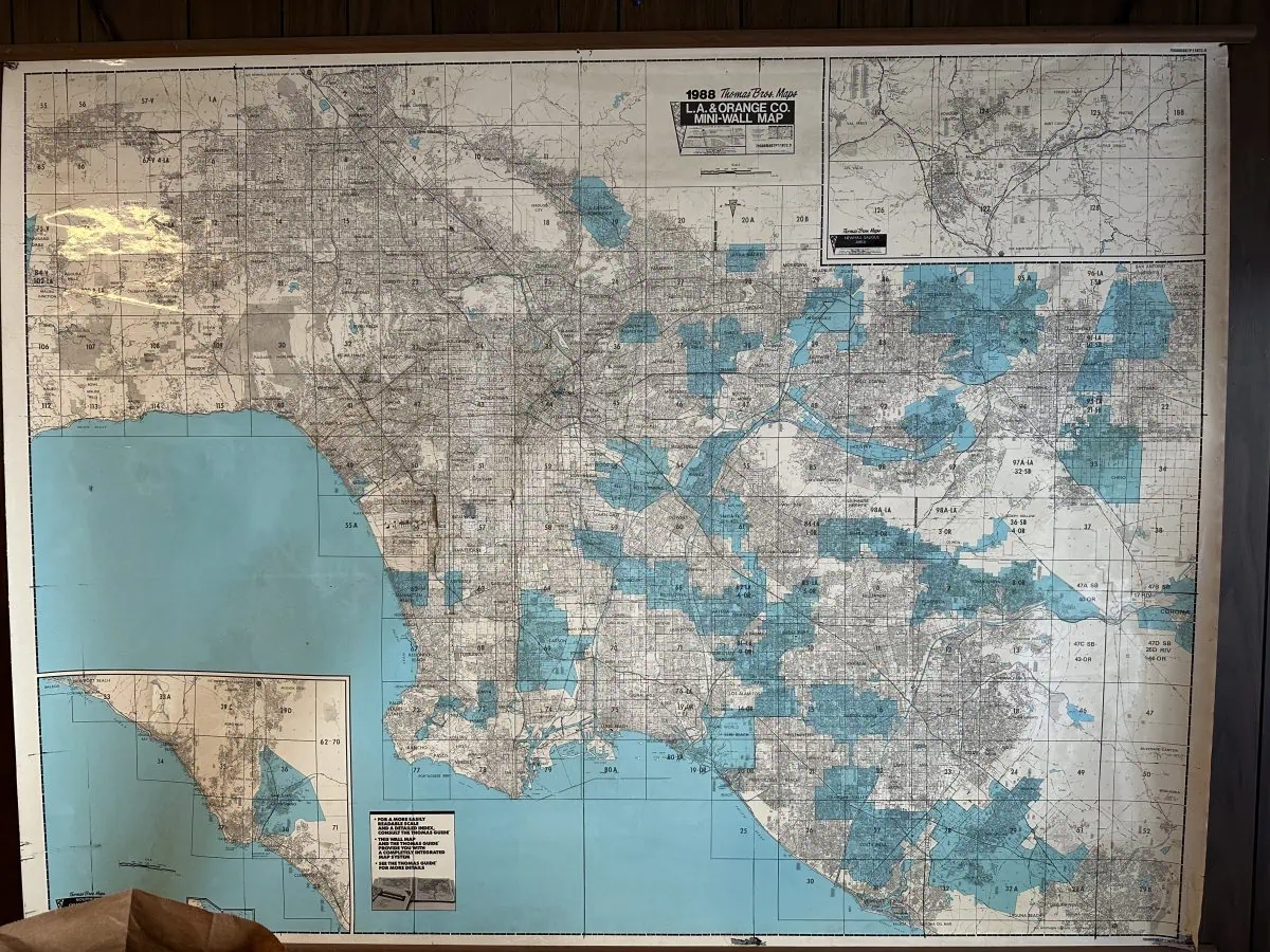
The Thomas Guide: Los Angeles in a Book
For many Southern California drivers, the Thomas Guide needs no introduction. The spiral-bound street atlas was a familiar companion for navigating a region too large to know street by street.
Its index directed you to a map page and grid location. Once there, you could find the street, check the block numbers and identify nearby intersections. An unfamiliar address became a specific place you could plan a trip to.
But finding the street name was only part of the job. You also had to find the correct section of that street and understand how to reach it. Our applicant test put that distinction to work.

Our Applicant Test: Find 15305 Morrison Street
When we interviewed driver applicants, we asked how they would get from one location to another. We wanted to see how they worked out a route, including whether they could use the Thomas Guide carefully enough to find an unfamiliar destination.
One address we used was 15305 Morrison Street in Sherman Oaks. We chose it because Morrison was an example of an east-west street that did not run continuously. Finding a section labeled “Morrison Street” did not necessarily mean an applicant had found the part containing that address.
They needed to examine the map closely, locate the correct block and identify the cross street. Simply finding the name and assuming they could follow the street straight through would not answer the question.
It was a practical test of attention to detail. Could the applicant turn an address into a location, and then explain how to reach it? That was something the job would require repeatedly, with a customer’s delivery depending on the answer.
Planning a Delivery Across Several Map Pages
Once a driver found the destination, the next task was connecting it to the pickup location. A printed map showed the streets, but it did not choose a route or announce which exit to take.
Imagine a pickup in Beverly Hills with a delivery somewhere unfamiliar in the San Fernando Valley. The driver had to work out the streets around the pickup, a route across town and the final approach to the delivery address.
A longer trip could continue onto several map pages. Following the connecting references meant keeping the overall route in mind while moving between detailed views of individual neighborhoods.
Useful details became things to remember: the major boulevard before the destination, the nearest cross street and the intersection that would mean you had gone too far. Drivers had to connect what they saw on paper with what they saw through the windshield.
A Missed Turn Did Not Come With “Recalculating”
One convenience of modern navigation is easy to take for granted: make a wrong turn, and the app works out another route.
A paper map stayed exactly as it was. To work out a correction, a driver needed to know where they were, which direction they were traveling and how the surrounding streets connected. When another look at the guide was necessary, the sensible approach was to pull over safely and get oriented.
Street signs, address numbers and recognizable landmarks all helped. So did understanding the neighborhood beyond a single set of turns. Our Morrison Street question tested that same habit: look carefully at how the roads actually connect.
Every Delivery Added to a Driver’s Knowledge
Repeated trips gradually connected the map to familiar places. A street that first required a search in the index could become a useful connection between two regular customers. A building could become a landmark for finding the next address.
Drivers also learned details that street maps could not show. An office might accept packages at a side entrance. A loading dock might be reached from the next street. A delivery to a large building might end at a receiving department rather than the lobby.
That knowledge accumulated one stop at a time. It remains useful today because reaching the address and completing the handoff are two separate parts of a delivery.
From Printed Maps to Live Courier Tracking
The Los Angeles Public Library’s look at navigation before GPS explores the street guides that helped people navigate the city. For those of us who worked with them, they also bring back a very different daily routine.
Digital navigation brought the map and the driver’s location together. Turn-by-turn directions reduced the need to memorize unfamiliar routes, while traffic information gave drivers more current information about the trip ahead.
The change extended into dispatch. A printed map could show where a customer was located, but it could not show where a driver was at that moment.
Today, A-1 Courier’s courier tracking system helps our dispatchers see driver locations and active routes in real time. That visibility supports decisions about pickups and deliveries as work moves through Los Angeles.
Serving Los Angeles Since 1988
Our old applicant test captures something about courier work that still matters. An address deserves a careful look. The street name, the correct block and the way into the destination all contribute to getting the delivery right.
A-1 Courier has served Los Angeles through the transition from printed guides to digital navigation. Today’s tools give our drivers and dispatchers better information, and experience helps them put that information to use.
Getting a price has changed, too. During normal business hours, Monday through Friday from 8:00 AM to 6:00 PM, visit the A-1 Courier homepage for an instant quote. Enter your delivery details, see your price and place your order online without waiting for a callback or email.
For help arranging a delivery, call A-1 Courier at 213-622-4000 or 310-450-9000.